- Página inicial
- →
- Biblioteca Digital Luso-Brasileira
- →
- BNDigital do Brasil
- →
- Ver item
JavaScript is disabled for your browser. Some features of this site may not work without it.
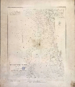
| Título: | Mouth of Chester river (harbor of refuge nº) from a trigonometrical survey under the direction of A.D.Bache superintendent of the ... |
| Autor/Colaborador: | Estados Unidos. Coast Survey |
| Data: | 1849 |
| Descrição: | 56 x 48 cm |
| Assuntos: | Chester river (United States) - Bathymetric maps |
| Chesapeake Bay - Bathymetric maps | |
| Chester, Rio (Estados Unidos) - Mapas batimétricos | |
| Chesapeak, Baía (Estados Unidos) - Mapas batimétricos | |
| Tipo: | Mapa |
 Acessar o documento na Instituição de origem
Visualizar