JavaScript is disabled for your browser. Some features of this site may not work without it.
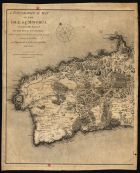
| Título: | A topographical map of the isle of Minorca: Geometrically Survey´d By The Royal Engineers, while it remained in the possesion of the French during the Last War |
| Autor/Colaborador: | Faden, William, 1749-1836 |
| Data: | 1st Jan[uar]y, 1780 |
| Descrição: | Monografia |
| Tipo: | material cartográfico, impresso |
| Material cartográfico] | |
| Idioma: | Inglês |
 Acessar o documento na Instituição de origem
Visualizar